By Eleanor Hoskins — Posted on Jun 02, 2015
One thing that many courses, especially in the Faculty of Education, are beginning to emphasize is the importance of place-based learning. Education that involves the geographical location it occurs in is re-emerging as a great way to engage students. It also gives lessons an added practical, demonstrated dimension that isn’t necessarily present in conventional Western models of teaching. Place-based learning is an integral component of Indigenous ways of knowing, which was covered extensively in our recently offered edX MOOC, Reconciliation through Indigenous Education.
My last post discussed a new mobile game called the Things We Carry, which is an app that follows a fictional student at Ohio University. Besides immersing users in an emotionally charged narrative, the application also relies heavily on geographical data to measure progress, and it actually requires the player to interact with physical objects in the location to move forward. All of these geographical functions are enabled by a platform called ARIS.
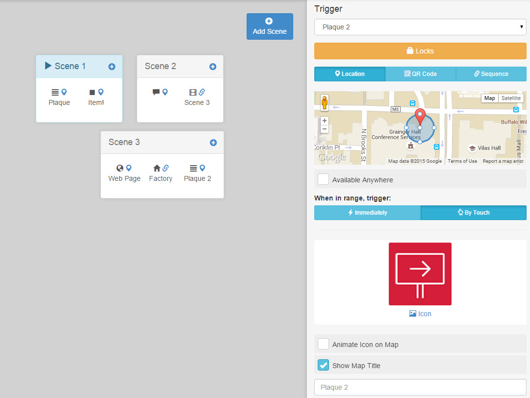
ARIS, or Augmented Reality and Interactive Storytelling, is a piece of free software for creating mobile games developed by a team at the University of Wisconsin-Madison. It features a simple, user-friendly interface, and it uses QR codes and GPS data to trigger game events and interactions. Players can interact with characters, collect items and complete quests within the app, and its open-source code makes it adaptable to very creative uses.
The application is easy to learn, and is a great way to enhance or gamify a field trip, to teach students about writing, game design, and logic, and to encourage new ways of exploring familiar places. Several institutions have programmed integrations that customize the experience even further—for example, a university in Spain has developed a game that uses a mobile microscope to allow students to analyze and identify local plants.
In further developments in place-based learning, UBC’s First Nations and Indigenous Studies Program has created Knowing the Land Beneath our Feet. This initiative includes a digital tour of campus that provides information about First Nations history and cultural landmarks. Knowing the Land Beneath our Feet is an opportunity to discover the physical reality that underpins the frequent recognition of the “traditional, ancestral and unceded territory of the Musqueam people”.
Mobile technology often gets a bad rap for distracting people from their surroundings, but programs like these call into question how deserved that reputation is. Clearly, they have immense potential to draw our attention back to physical place.
Additional Resources
- ARIS Home
- Knowing the Land Beneath our Feet
- The Talon: Knowing the Land Beneath our Feet: UBC’s Indigenous Histories and Presence